Sandra Lach Arlinghaus Ph.D.
Adjunct Professor of Mathematical Geography and Population-Environment Dynamics
School of Natural Resources and Environment
The University of Michigan, Ann Arbor
Please
set screen to highest
resolution and use a high speed internet
connection.
Please download the most recent free
version of Google
Earth®.
Make sure the
"Terrain"
box in Google Earth® is checked.
|
Download
the following file to use in Google Earth®:
30 meter placemarks for Banda Aceh |
December
26, 2004. A devastating earthquake (9+ on the Richter
scale) hit
the Indian Ocean from an epicenter just to the west of
Sumatra.
Killer tsunamis followed this earthquake. These affected
severely
much of the populated area on the Indian Ocean perimeter.
Much
has been written about the events and scholars from a wide range
of
disciplines have analyzed it from numerous perspectives [see a
few
Internet references below]. One way to look at the current
status
of the affected region around Banda Aceh, a city in northern
Sumatra to
the northeast of the earthquake epicenter, is to view the region
in Google
Earth®
Figure 1 shows a direct screenshot from Google Earth® Scroll across the image; notice destroyed bridges. Much land remains inundated, especially of course along the coast. If one supposes that a tsunami wave might have been 30 meters in depth, then one imagines a sheet of water coming in from the northern tip of Sumatra and extending inland as far as the 30 meter terrain contour. Click here to see a movie, made in Google Earth® , of the devastation surrounding a sequence of markers placed along the coastal region just to the north of Banda Aceh (the movie file is over 47 MB in size).
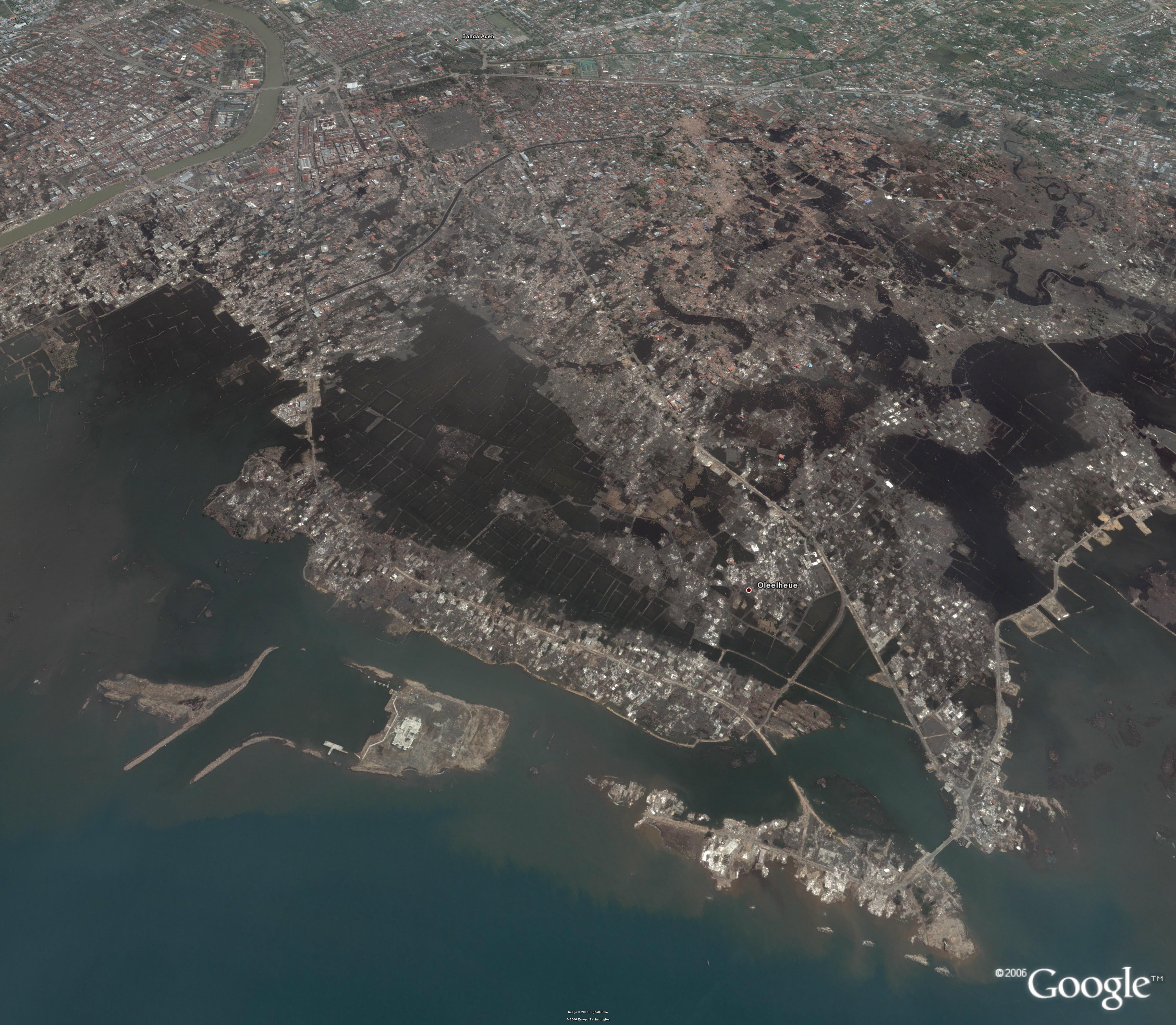 Figure 1. The Banda Aceh region, two years after a hit by a deadly tsunami. |
To
track the 30 foot contour in Google Earth®,
placemarks were located in that software on top of pointer
positions at
the 30 meter level. Try it yourself in Google Earth®.
Download the placemarks file, created by hand, from the box
above. Figure 2 shows one screen shot of that
file. As
expected, there is an inset area away from the coast adjacent
to Banda
Aceh. Also, though, there is a channel that cuts through
to the
western coast of Sumatra in the direction on the earthquake
epicenter. This channel might have served as a back door
for a
double-effect hit. Look at the evidence of screen shots
in
Figures 2 and 3; look at the intersection of coastal zone and
the
extension from the channel. It appears to have been
particularly
hard-hit. Drive around in Google Earth®
and see for yourself. What do you think? Does the
fact that
the western Sumatra "backdoor" entry is wide at the coast, and
then
narrows to a channel through the highlands suggest even
further piling
up of waters (much as with tides in the Bay of Fundy)?
If so, one
might expect to see damage above the 30 meter levels--Google Earth®offers
that opportunity. Might simple, clear advice in the face of
disaster
simply be the common sense approach to seek out the high
ground (here,
perhaps, above 30 meters)? Observations such
as these, coupled with the use of state-of-the-art support
systems,
might help guide future research or relief projects.
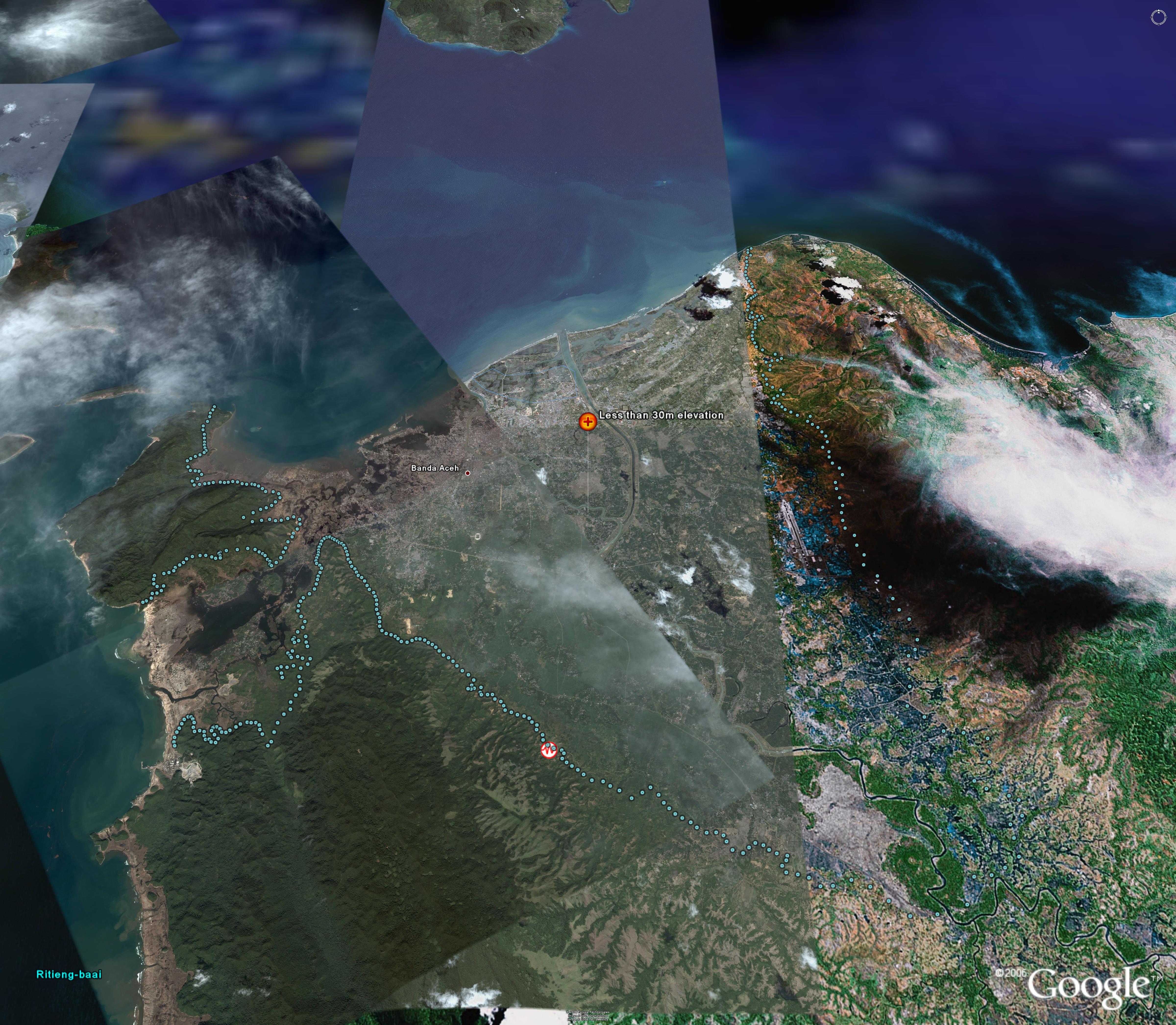 Figure 2. Banda Aceh. Light cyan dots trace out 30 meter contour. Red and white circles mark previous nearby earthquake activity (the Indian Ocean earthquake of 2004 occurred farther to the west and does not appear here). |
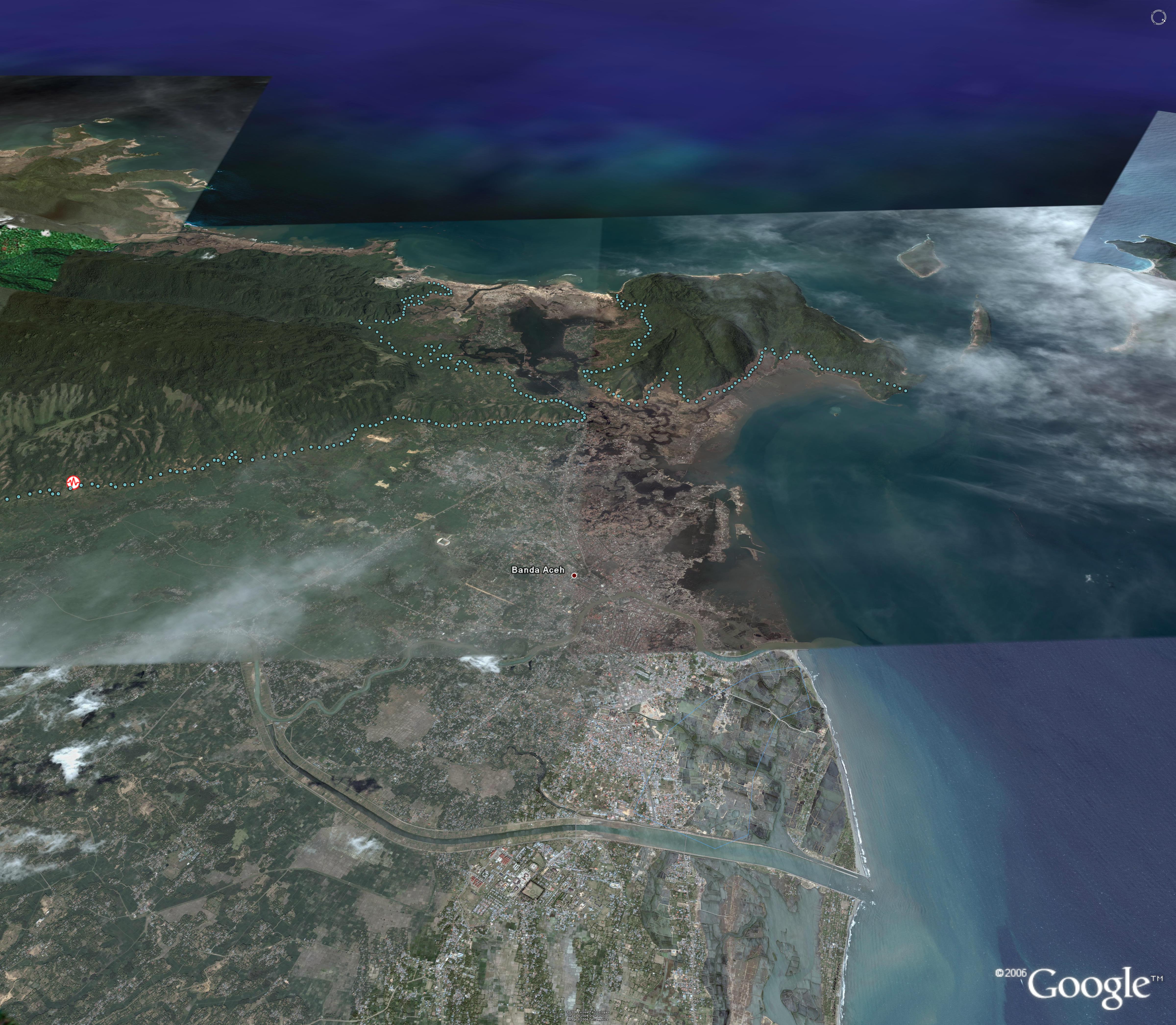 Figure 3 A view toward the west. Scroll across as well as down. |
Related References:
- Asian Tsunami Maps from Global Security.
- The
December
26, 2004 Sumatran Tsunami.
* The author wishes to
thank Kris
S.
Oswalt
M.B.A., President Community Systems Foundation, 219 S.
Main
Street, Suite 206, Ann Arbor, MI 48104, for his suggestion of
Banda
Aceh as a region of interest to consider using this
technology.
Solstice:
An Electronic Journal of Geography and Mathematics,
Volume XVII,
Number 2
Institute of Mathematical Geography (IMaGe).
All rights reserved worldwide, by IMaGe and by the authors.
Please contact an appropriate party concerning citation of this article: sarhaus@umich.edu
http://www.imagenet.org
Institute of Mathematical Geography (IMaGe).
All rights reserved worldwide, by IMaGe and by the authors.
Please contact an appropriate party concerning citation of this article: sarhaus@umich.edu
http://www.imagenet.org