Volume II, Book 2:
Making It Clear: The Importance of Transparency
Sandra Lach Arlinghaus
sarhaus@umich.edu
http://www-personal.umich.edu/~sarhaus/
ANNOTATED
RELATED LINKS
BURUNDI BUFFERS: DEVINFO TO GOOGLE EARTH
BURUNDI BUFFERS: DEVINFO TO GOOGLE EARTH
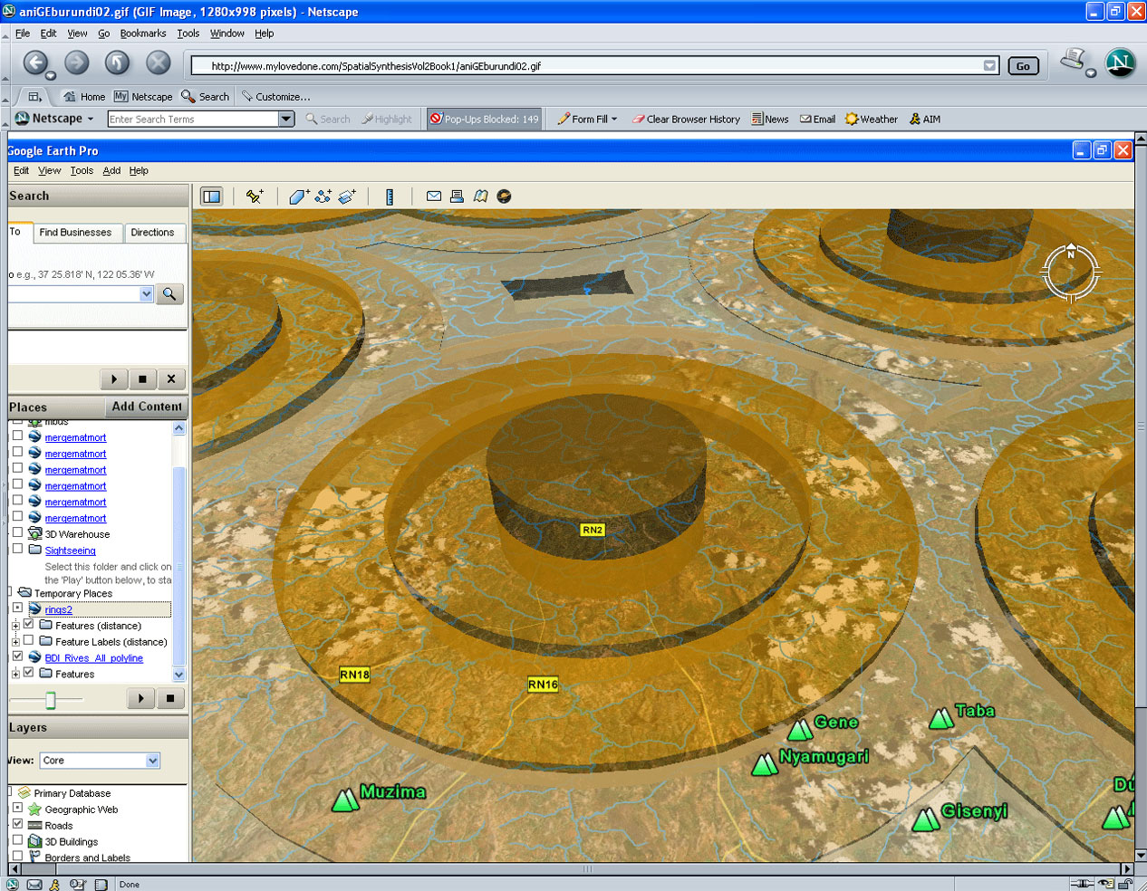 |
IMaGe LINKS
The links in this
section suggest a variety of uses, most involving
transparency and
others involving related ideas, for spatial buffers.
Buffers are
often used to represent tributary errors to point
locations--the city
and its hinterland, and so forth. Partially
transparent buffers
permit us to look through to other maps, as Schlossberg
suggests.
Later work lets partially transparent reveal terrain and
all that
Google Earth has to offer.
When Google Earth is linked to DevInfo, particularly strong possibilities for 3D modeling in developing nations become apparent (see the first book below). DevInfo is software in place, through the United Nations, in over 80 developing nations of the world. It was developed by Community Systems Foundation (Ann Arbor), an international NGO in partnership with the United Nations. The backbone of the software is GIS. It is a stand alone package that is given to client nations along with training so that they become self-sufficient in monitoring and evaluating a host of humanitarian issues. It has seen use in a variety of humanitarian applications, from maternal and child health care to rescue efforts following earthquakes. Related links: http://www.CommunitySystemsFoundation.org/ ; http://www.csfnet.org/
In eBooks:
- Spatial Synthesis: Scientific, Planning, Humanitarian, and Teaching Applications, From DevInfo to Google Earth. Volume II, Book 1. September 2008. Sandra L. Arlinghaus, et al.
- Spatial Synthesis: Centrality and Hierarchy. Volume I, Book 1. Sandra Lach Arlinghaus and William Charles Arlinghaus. June 21, 2005.
- Volume XV, Number 1, 2004 Visualizing Accessibility II: Access to Food Marc Schlossberg
- Volume XIV, Number 2, 2003 Tornado Siren Location, Response to Previous Article
- Letter from United States Member of Congress, John Dingell
- Quotations from articles in The Ann Arbor News
- Volume XIV, Number 1, 2003 Tornado Siren Location: Ann Arbor, Michigan Sandra Lach Arlinghaus
- Volume XIII, Number 2, 2002 Visual Accessibility with GIS Marc Schlossberg
- Volume XII, Number 2, 2001 Base Maps, Buffers, and Bisectors Sandra Lach Arlinghaus
- Volume X, Number 2 A Map of Jackson, Mississippi Sandra L. Arlinghaus
Software
used
in analysis:
- DevInfo
5.0:
http://www.devinfo.org/
- Adobe® PhotoShop and ImageReady
- Adobe® DreamWeaver
- ESRI:
- ArcView® 3.2
- ArcGIS® 9.2
- ArcCatalog®
- ArcMap®
- Google Earth®
Author
affiliation:
Arlinghaus, Sandra Lach. Adjunct Professor of Mathematical Geography and Population-Environment Dynamics, School of Natural Resources and Environment, The University of Michigan. Executive Committee Member (Secretary) Community Systems Foundation, sarhaus@umich.edu, http://www-personal.umich.edu/~sarhaus/
Arlinghaus, Sandra Lach. Adjunct Professor of Mathematical Geography and Population-Environment Dynamics, School of Natural Resources and Environment, The University of Michigan. Executive Committee Member (Secretary) Community Systems Foundation, sarhaus@umich.edu, http://www-personal.umich.edu/~sarhaus/
Published by:
Institute of Mathematical Geography
http://www.imagenet.org
http://deepblue.lib.umich.edu/handle/2027.42/58219
October, 2008.
Copyright by Sandra Arlinghaus, all rights reserved.